Winter 2020 is on its way
Log in to replyHome › Forums › General › Non RS Chat › Winter 2020 is on its way
- This topic has 285 replies, 24 voices, and was last updated 3 years, 1 month ago by
 71-bda.
-
AuthorPosts
-
October 29, 2020 at 11:18 AM #159523
As some of you know I cheer you up with the winter weather from around the world. It is a little early yet for the worst of the weather but early indications are that winter is on its way and it would appear to be a little early in some places.
It’s only October, but forecasters are warning that there may be snow in the higher elevations of Metro Vancouver on Friday morning, followed by a weekend of unseasonably cold weather. A special weather statement from Environment Canada on Thursday says that a modified Arctic air mass could bring early season wet snow to areas with elevations over 300 metres in Vancouver, the North Shore, Burnaby, New Westminster, Coquitlam and Maple Ridge. The system is expected to move out of the region by Friday night, but it’ll be replaced by a cold air mass that will send temperatures plunging to 6-8 C below seasonal normals, with temperatures around freezing forecast over the weekend nights. Widespread snow is also expected across most of the southern half of the province, from Bella Coola and Whistler in the west to 100 Mile and the southwest Interior, and all the way to the Kootenays and parts of the Columbias.
The expected snowfall comes after a big dump of the white stuff hit Prince George earlier this week, with some areas seeing accumulations of up to 15 centimetres.
Honorary Member
October 29, 2020 at 11:28 AM #159524A week ago and the first snows for Norway, short lived turned to rain but by the end of next week it could return with more light flurries.
Honorary Member
October 29, 2020 at 11:35 AM #159525A week ago in Finland, once again short lived but more is expected in the next two weeks.
Honorary Member
October 29, 2020 at 11:38 AM #159526North America seeing early cold snap
Early-season winter storm hits northern U.S., breaking scores of snowfall records
Honorary Member
October 29, 2020 at 12:08 PM #159527Prediction for the UK bobcat??
October 29, 2020 at 12:25 PM #159528@paul-m, I’ll see what I can find. The long range weather forecast for the U.K. (end November) is cold and wet with Scotland having some odd snow flurries.
Honorary Member
October 29, 2020 at 4:43 PM #159543The first snow of the season fell overnight Sunday and left a light dusting throughout the Anchorage Bowl, with accumulations of up to 2 inches on the east side of town, meteorologists said.
A weather system moved into the area from the western Gulf coast late Saturday, and a light snow began falling in the Anchorage Bowl around 1 a.m., said National Weather Service meteorologist Kaitlyn O’Brien.
By early Sunday there was a dusting of snow throughout the Anchorage Bowl, and O’Brien said by afternoon reports in West Anchorage ranged from about a half-inch to an inch of snow. In upper elevations throughout the municipality, including Anchorage Hillside and Eagle River, accumulations of 1.5 to 2 inches of snow were reported.
Honorary Member
October 30, 2020 at 9:11 AM #159618Today saw further showers across the northern and eastern Alps, bringing a little snow above 1500-1900m, with the best of any sunshine in the south-western Alps. Madonna di Campiglio (due to open 21 November) has had more snow than most recently, but much of its lower-lying snow will melt over the next few days – 29 October 2020 – Photo: funiviecampiglio.it
Tomorrow will see showers across the eastern Austrian Alps (e.g. Obertauern), but with a higher rain/snow limit, rising to 2500m or so. It will be mostly dry elsewhere, with plenty of sunshine in the southern and western Alps. The weather at the weekend then looks as if it will be fine and very mild across the board.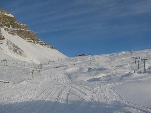
Honorary Member
October 30, 2020 at 9:14 AM #159619Look forward to hearing from club members around the world for their weather news this winter.
Honorary Member
October 30, 2020 at 12:52 PM #159632Thanks again, bobcat.
Hmm, let’s see, I fancy the Klausenpass this weekend, open, snow covered 😎
https://www.alpen-paesse.ch/en/
Revo Stage 1 – JCR super low seating frame – Mishimoto gas pedal spacer – DSC sport controller
October 30, 2020 at 1:20 PM #159635@frenk, that’s a beautiful place, although there’s not much more snow in the next couple of days there’s plenty more coming next week.
The weather forecast for Friday, 30.10.2020 for Klausenpass, Uri, Switzerland
After the mostly cloudy skies in the morning it is slightly cloudy during the day. The afternoon is slightly cloudy. Morning temperatures will be around 4 degrees. During the day the temperature reaches a maximum of 9 degrees. In the night the low temperature is 4 degrees. The south wind blow at first weak, at night weak from Süd.On Saturday the sky alternate overcast, so the sun can shine through more frequent. Morning temperatures will be around 4 degrees. During the day the temperature reaches a maximum of 11 degrees. At night the low temperature is 4 degrees. The south wind is blowing weak.
Sunday it will be mostly cloudy with only scattered cloud gaps. Morning temperatures will be around 4 degrees. During the day the temperature reaches a maximum of 10 degrees. At night the low temperature is 6 degrees. The south wind is blowing weak.
On subsequent days it can snow. Morning temperatures will be around -1 degrees. During the day the temperature reaches a maximum of 11 degrees. The wind comes from the south with an average of 7 Km/h.
Honorary Member
November 1, 2020 at 9:31 AM #159789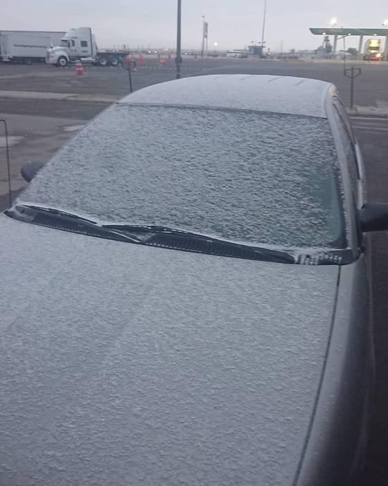
Mexico – Snowfall in the middle of October
For the city of Chihuahua, it is expected that the thermometer will drop to -1C tonight. And record “snow water.”
In the middle of autumn. Tuesday, 27 Oct 2020 – An atypical end of October, with record precipitation of freezing rain (commonly known as snow water), snow and hail; with temperatures down to -2 degrees, all due to cold front number 9. The cold front was forecast to reach Chihuahua Capital today with temperatures down to -1C. This was reported by Tiempo Severo Chihuahua, which said the rainfall on Monday night and early Tuesday in Ciudad Juárez was is part of a rare meteorological phenomenon.Honorary Member
November 1, 2020 at 4:20 PM #159821Major early-season winter storm brings heavy snow and record cold temperatures to U.S.
Widespread heavy snow falling across the central Rockies and central Plains is forecast to shift further south and develop into another major winter storm for the southern High Plains Monday into Tuesday, October 26 into 27, according to the National Weather Service (NWS). The station in Potomac, Montana, recorded -33 °C (-29 °F) on Sunday morning, October 25 — the lowest temperature at an official climate site in the U.S. this early in the season. More record cold temperatures are expected to engulf the affected regions over the next couple of days.
An area of freezing rain and sleet is forecast to develop over portions of the southern Plains to start the week.
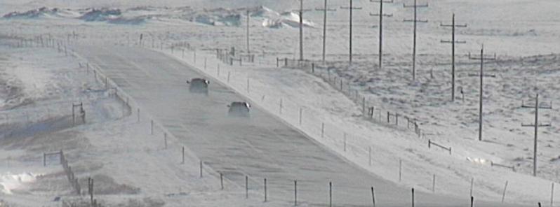
The new, early-season major winter storm across the central Rockies to the Plains is showing no sign of abating. It comes on the heels of another early-season winter storm which hit parts of the northern U.S. last week, breaking scores of snowfall records in Montana, Iowa, and Minnesota.Storm warnings, winter storm watches, and winter weather advisories have been issued from the central and southern Rockies into the Plains, as far south as West Texas and Oklahoma.
Heavy snow started in Washington State, northern Idaho, and Montana on Friday, October 23. Up to 63 cm (25 inches) of snow already fell southwest of Helena, Montana. This was the sixth heaviest two-day snowfall on record in the area.
Honorary Member
November 3, 2020 at 8:58 AM #159915Early even for Canada
Honorary Member
November 3, 2020 at 9:06 AM #159916 -
AuthorPosts