Winter 2021/2022
Log in to replyHome › Forums › General › Non RS Chat › Winter 2021/2022
- This topic has 113 replies, 14 voices, and was last updated 2 years, 1 month ago by
 Andrew.
-
AuthorPosts
-
December 3, 2021 at 4:16 PM #182989
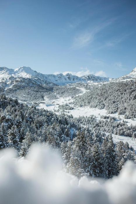
Switzerland
Saturday will be mostly cloudy in the Swiss Alps, with spells of rain/snow across many regions, especially in the north and west (e.g. Jungfrau region, Verbier). The south, especially Ticino, will see less precipitation. The rain/snow limit will start low, and remain quite low in some enclosed valleys, but will rise to between 1000m and 1300m in some exposed parts of the north and west (e.g. Engelberg, Jungfrau region, Portes du Soleil). It will turn much colder on Sunday, with snow showers to very low levels across many parts of the Alps. However, the far south will be drier again with the possibility of some sunny spells. By Monday, flurries will be more confined to the northern Alps (e.g. Jungfrau region, Engelberg) where snow will continue to fall to low levels.Honorary Member
December 3, 2021 at 4:36 PM #182990Grandvalira Spain yesterday
Honorary Member
December 6, 2021 at 2:51 PM #183146Blizzard warning issued for Hawaii with at least 12 inches of snow forecast
In addition to blizzard conditions, wind gusts over 100 mph are also expected, according to the alert issued by National Weather Service Honolulu. A blizzard warning for tropical Hawaii may come as a surprise, but snow is not uncommon; the summits of the Big Island’s Mauna Kea and Mauna Loa volcanoes reach nearly 14,000 feet in elevation. Elsewhere in the United States, a storm system is expected to sweep from the northern Rockies to northern Great Lakes, bringing a blast of snow and gusty winds later this weekend. Winter storm watches and warnings have been issued from Montana to northern Wisconsin, where more than a half a foot of snow is possible this weekend. Strong, gusty winds will also impact parts of the northern Rockies later Saturday into Saturday night. High wind alerts are in effect from Great Falls, Montana, to Cheyenne, Wyoming.Honorary Member
December 7, 2021 at 2:58 PM #183172December 8, 2021 at 3:51 PM #183199Milan Italy today
First mixed with rain, then more abundant. Respect the weather forecast: in Milan, as in the Po Valley, the first snow of the season began to fall in the early hours of Wednesday 8 December morning, after dawn. According to forecasts, the phenomenon will intensify during the day? Since the early hours of the night, the Municipality has prepared the action of the salt spreaders, on the roads and in the critical points, such as the stops of the surface vehicles of Atm. And he invited condominium administrators and traders to do the same as far as they are concerned, on the sidewalks in front of private buildings and shop entrances. Palazzo Marino also recommended that citizens limit the use of cars as much as possible.
Ice risk
According to the weather alert issued by the civil protection of the Lombardy Region, the snowfall will diminish towards the evening of 8 December. In the Milan area, an accumulation of snow of 5-10 centimeters is expected. Starting from the night between Wednesday and Thursday, temperatures will drop significantly. The Municipality has already warned the Milanese to pay particular attention to the formation of ice on the roads.Honorary Member
December 9, 2021 at 9:43 AM #183211AUSTRIA FORECAST After the snowfall last week there have been a few clearer days midweek, although temperatures have remained close to freezing in the valleys and well below in the mountains. The snowfall is due to return into the latter half of this week and continue through the weekend with more light to moderate falls for many Austrian areas.
SWITZERLAND FORECAST The low temperatures – dropping as low as -25C in the mountains – are set to continue. A moderate snowfall is expected midweek before largely drier weather into the weekend. Some sunshine is forecast Thursday/Friday but staying very cold. FRANCE FORECAST Skies will remain largely overcast and temperatures low for the coming week. There’s a bit of a lull in the snowfall midweek but the latter half of this week will see more moderate to heavy snowfall as the good start to December continues. Lighter snowfall and some periods of sunshine towards the weekend. ITALY FORECAST After a quieter start to the week, a band of moderate to heavy snowfall will move across Italy midweek, before another spell of clearer, sunny weather, then light to moderate snowfall (present forecast) returning at the weekend. Temperatures stay below freezing, often double-digits below in the mountains.
GERMANY FORECAST More snowfall midweek and temperatures double-digits subzero Celsius. Skies clearing later in the week but staying below freezing.BULGARIA / ROMANIA FORECAST A band of moderate midweek snowfall should begin to ease late Wednesday/Thursday and clearer weather return. Temperatures stay at freezing or below for most areas though allowing snowmaking to continue overnight in the run-up to the main season start.
CZECH REPUBLIC / SLOVAKIA FORECAST After quieter weather and some sunny spells midweek, more snowfall is expected for the latter half of this week. Staying below freezing day and night.Honorary Member
December 9, 2021 at 9:44 AM #183212America
ROCKIES FORECAST Temperatures continue to fluctuate a good way on either side of the freezing point, dropping well below overnight to allow snowmaking but then climbing 5-10 degrees above in the daytime. It’s been another sunny week but there are signs of change now. Increasingly cloudy as storms move through over the coming week. It’s not clear if there will be huge snowfalls resulting and the weather still looks warm at times, but Friday looks the most promising for at least a few inches and hopefully much more snowfall.
Honorary Member
December 9, 2021 at 9:45 AM #183213USA WEST FORECAST After weeks with no snow, a front moving in just before the weekend could bring several feet of snow at last over the latter half of this week to the Pacific Northwest. Not so much further south in California, more like 4-8 inches of snow there, which would still be a major boost. Equally important for many some consistently low temperatures, at last.
Honorary Member
-
This reply was modified 2 years, 4 months ago by
 bobcat.
December 9, 2021 at 9:48 AM #183215CANADA WEST FORECAST A drier week forecast for much of the region with a mixture of sunshine and overcast skies. Some snowfall is expected at times but this timer lighter accumulations. Inland temperatures10-20 degrees below freezing.
CANADA EAST FORECAST It’s looking cold through the rest of the week but mostly dry, although some light snow showers are possible. There are worrying early signs of another bit of warm weather coming at the weekend though which could mean more rain for some, so a normal winter is not quite here yet.
Honorary Member
December 9, 2021 at 9:49 AM #183216JAPAN FORECAST Unfortunately, there may be a bit of a blip this week as warm weather crosses the Sea of Japan and stops the snowfall for the time being. There looks to be colder, snowier conditions moving back in behind it though.
Honorary Member
December 12, 2021 at 7:27 PM #183365America
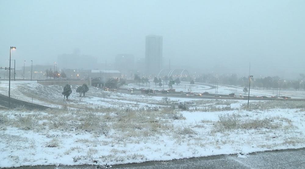
DENVER – We’re finally getting some meaningful and widespread snowfall in the Colorado mountains to round out this week, which should be a much-needed boost for the meager snowpack. Meanwhile, a whopping three-tenths of an inch of snow fell at Denver International Airport Friday, setting the new record for the latest-ever first snowfall in a season and putting 2021 tied for first all-time on the list of longest snowless streaks. Winter storm warnings and winter weather advisories are in effect for the mountain until Friday afternoon, where some higher elevations could get 2 feet of snow.
Honorary Member
December 17, 2021 at 3:42 PM #183541Will get a white Christmas? Probably not……. I hope🤫
THE final ‘major’ storm of 2021 will see Britain battered by a ‘snow bomb’, severe gales and heavy rain. While a White Christmas seems unlikely for most, the brutal conditions are expected to hit two days later on December 27. Following Storms Arwen and Barra earlier this month, much of the country is currently enjoying unseasonably warm temperatures that have seen the mercury rise to 14C in recent days. But according to Netweather.tv, the post Christmas ‘snow bomb’ will send temperatures plummeting again in the first of what will be FIVE more storms before the end of winter.
Odds slashed on coldest January
Leading bookmaker Coral has cut the odds on this January being the coldest since records began to just 2-1 (from 5-1) as forecasters warn of an end to the mild winter temperatures. “We have enjoyed some very mild temperatures through December but the outlook for January looks a lot colder and we have slashed the odds on next month being the coldest first month of the year we have ever had,” said Coral’s Harry Aitkenhead. Coral make Edinburgh the favourite for snow on Christmas Day, at odds of 3-1, with Newcastle the most likely of the English cities at 7-2 according to the odds. Harry also said: “We are offering odds on all major UK cities for any punters dreaming of a White Christmas, with Edinburgh the most likely according to our odds”.Hope the weather goes the way you want it 😺👍
Honorary Member
December 23, 2021 at 11:13 AM #183772Canada
Canadians dreaming of waking up to a white Christmas could be in for mixed results on Dec. 25, although some are likely to still see snowflakes on the big day. Environment Canada’s seven-day forecasts now include predicted weather outcomes for Christmas Day. Some locations might see snowfall during the week and stay cool, while others may simply be left hoping for a light dusting on Dec. 25. December hasn’t exactly gone to plan, with some meteorologists having predicted more wintery weather, but there’s still a chance for many Canadians to take up to a beautiful Christmas morning.
BRITISH COLUMBIA
Vancouver: Temperatures above freezing in the city may help keep any snowfall during the week off the ground, but snow on the night of Dec. 24 and periods of snow with a high of zero degrees Celsius are in the forecast for Christmas Day.Victoria: It’s a similar story in the provincial capital, with rainfall and temps above freezing throughout the week, but periods of snow are expected at night on Christmas Eve as well as on Dec. 25, which will have a high of one degree Celsius.
ALBERTA
Calgary: Temperatures will stay below freezing during a mostly cloudy week, with a snow in the forecast on Dec. 23 and chances of flurries as well as lower temperatures from that night until Christmas Day.Edmonton: Temperatures will remain below freezing all week, and varying levels of snowfall are expected from Monday night until Thursday. There’s a 60-per-cent chance of flurries on the nights of Dec. 23 and 24, as well as Christmas Day.
SASKATCHEWAN
Saskatoon: Temperatures well below freezing are expected all week, which will be mostly cloudy, with snow on Dec. 23 and a 60-per-cent chance of flurries on both the night of Dec. 24 and Christmas Day.SASKATCHEWAN
Saskatoon: Temperatures well below freezing are expected all week, which will be mostly cloudy, with snow on Dec. 23 and a 60-per-cent chance of flurries on both the night of Dec. 24 and Christmas Day.Regina: Although no snowfall is forecast for Christmas, temperatures are set to remain below freezing during a week mixed with sun and clouds. There’s a 60-per-cent chance of flurries the night of Dec. 23.
MANITOBA
Winnipeg: Winnipeggers have a decent chance at a white Christmas as they may experience temperatures below freezing under mostly cloudy skies with snow on Monday and Thursday nights. There’s also a 60-per-cent chance of flurries on Christmas Eve.ONTARIO
Toronto: The city might get some snow on Dec. 25, with a 60-per-cent chance of rain or flurries on top of rain or snow from the night before, but any other snowfall accumulated throughout the week may be affected by temperatures hovering at zero degrees Celsius or above this week.Ottawa: The nation’s capital will see temperatures just below the freezing mark and cloudy conditions this week, with periods of snow expected the night of Dec. 24 into Christmas.
QUEBEC
Montreal: Mostly below-freezing temperatures with chances of flurries starting the night of Dec. 23 up until Christmas, when a snowfall is expected, gives the city good odds for a beautiful holiday.Quebec City: A 60-per-cent chance of flurries on Wednesday, as well as the night of Christmas Eve into Dec. 25, combined with below-freezing temperatures gives Quebec City a good shot at a white Christmas as well.
NEW BRUNSWICK
Moncton: Snow is forecast on Wednesday night, and temperatures below freezing with a mix of sun and clouds the following two days. There’s also a 60-per-cent chance of flurries on Christmas day.Fredericton: Snowfall on Wednesday, below-freezing temperatures, partly cloudy conditions and flurries forecast on Dec. 25 could mean a pleasant dusting of snow on Christmas.
Honorary Member
December 23, 2021 at 11:18 AM #183773America
https://abcnews.go.com/US/winter-storms-bring-extreme-weather-east-west-coasts/story?id=81875983
Honorary Member
December 25, 2021 at 7:56 PM #183853@gary1234, I found a moment of peace. Wherever you go enjoy
The Caribbean
The northernmost islands – Bermuda and the Bahamas – enjoy a warm rather than hot January, with air and sea temperatures reaching a maximum of 20°C. Carrying a light sweater is a good idea, although even overnight temperatures don’t fall lower than 15°C. The mild temperatures mean humidity is not an issue. However, with five hours of sunshine per day, die-hard sun-seekers might want to wait until May or later. With the Bahamas’ New Year parade, January is the end of the high season, and as a result, prices for hotels and flights are higher than other times of year. Cuba, Jamaica, the Turks and Caicos and the Cayman Islands experience a warmer January than Bermuda and the Bahamas. Located further south, these islands have night time lows of 17°C, but daytime highs of 26°C. For water sports and swimming, the seas around Cuba are a very comfortable 25°C. Humidity is of little concern, while there are on average seven hours of sunshine a day. There are eight hours of sunshine a day on the southernmost of the Caribbean islands. Antigua, St Luciaand Barbados see January temperatures that range from 21°C overnight, to 29°C during the day. UV levels are very high in the southern Caribbean, making sunscreen a must. While humidity is more noticeable than islands further north, it is unlikely to affect visitors.
The Caribbean in January offers ideal weather for a winter beach vacation. You can expect warm and dry weather throughout the islands.
Temperature
January is the coolest month of the year for most of the Caribbean. That’s not saying much, because temperatures there vary so little from season to season. Daytime highs are typically comfortably hot, while the nights remain warm. With winter settled in, temperatures across the region follow a gradient from north to south. The coolest weather is in the north, the Bahamas, while the hottest days are on the southernmost island of Trinidad. Ocean temperatures in January range on average from 77 degrees Fahrenheit around the Bahamas and Puerto Rico to 79 °F around islands farther south.Rainfall
The Caribbean’s dry season begins in January. This normally is the driest month of the year for Kingston, Jamaica and Nassau, Bahamas.Honorary Member
-
This reply was modified 2 years, 4 months ago by
-
AuthorPosts