Winter 2020 is on its way
Log in to replyHome › Forums › General › Non RS Chat › Winter 2020 is on its way
- This topic has 285 replies, 24 voices, and was last updated 3 years, 2 months ago by
 71-bda.
-
AuthorPosts
-
November 28, 2020 at 8:09 PM #161971
Christmas weather forecast. The last widespread White Christmas in the UK was in 2010. December was an extremely cold month that year and according to the Met Office 83% of stations recorded snow on the ground on December 25th. This year marks the tenth anniversary and since then we have had some exceptionally mild winters. Will this year buck the trend? At this stage the TWO view is there is a greater than average chance of cold snaps occurring during December 2020. In particular the chance of northwesterly flows is elevated. Generally they bring rather cold conditions to the UK in the winter months with the greatest risk of snow in northern and western coastal areas. Disturbances can result in more widespread snow. Snow on Christmas Day this year is considered to be most likely in the north and west. As usual in the UK high ground is more likely to see some of the white stuff.
The latest considerations are:
1) Recent weather patterns
2) Indications of colder weather through the first third of December
3) GEFS35 now covers the Christmas period
4) The likelihood of La Nina conditions
The Computer says
It’s expected to be too mild for snow in the south
It’s expected to be too mild for snow in Wales
It’s expected to be too mild for snow in the Midlands
It’s expected to be too mild for snow in the north
Cold conditions in Scotland are expected, marginal for rain or snow.
It’s expected to be too mild for snow in Northern Ireland
It’s expected to be too mild for snow in the Republic of Ireland
It’s expected to be too mild for snow in the Netherlands
@alloy, I take no responsibility for the weather let alone the forecast Ha Ha Ha .Honorary Member
November 28, 2020 at 8:12 PM #161973I hope you guys and girls come trumps with your winter pics …… please 👍
Honorary Member
November 28, 2020 at 8:30 PM #161978@bobcat , you want our Trump here form the States?
He’ll be available by end of Jan next year. 🤣
November 28, 2020 at 8:44 PM #161984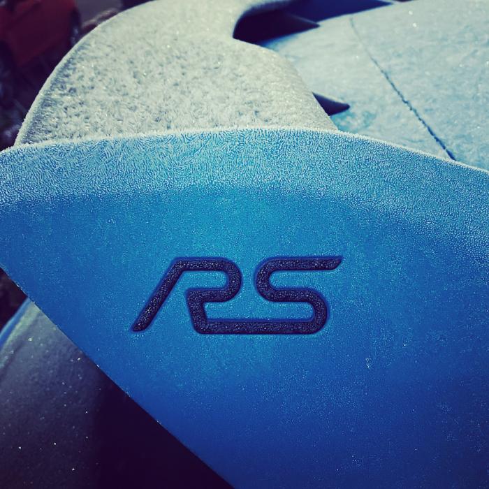 November 28, 2020 at 8:48 PM #161986
@nicklulu, that’s one trump we don’t need thank you 😹😹😹. Your winter pics would be great even if you have sunshine 👍
Honorary Member
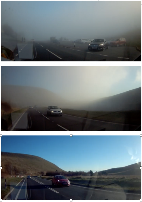
November 28, 2020 at 8:49 PM #161987November 28, 2020 at 9:15 PM #161993This was Friday with us Mental -2 fog in Brecon to Sunny day in a few 100m
 November 28, 2020 at 9:20 PM #161994
I do miss living in Minnesota once in a while.
As long as I don’t need to shovel the driveway with 2 feet of snow!
November 29, 2020 at 9:38 AM #162032December 1, 2020 at 8:04 AM #162185Winter has arrived on time. This morning, december 1st, 1 °C, out of my window, south of Basel.

And yes, the roads are slippery, but no doughnuts yet 😉
Revo Stage 1 – JCR super low seating frame – Mishimoto gas pedal spacer – DSC sport controller
December 1, 2020 at 8:42 AM #162189@frenk, thanks for sharing your weather picture. Looks like a good dusting you’ve had 🥶😺👍
Keep them coming please
Honorary Member
December 1, 2020 at 10:20 AM #162193I think winter is here. – 1 and frozen solid when I went to the car this morning. Wish we could have summer back, I hate being cold🥶🥶🥶
Collins Cp2 map. Ramair induction. Mountune mud flaps. Scorpion Sports Cat. Scorpion Tracker. Wind deflectors. NB washer jets and shark fin aerial. EBC Grooved discs, YellowStuff pads. Airtec Intercooler, Miltek cat back with titanium tips. Collins quickshift. DSC Controller
December 1, 2020 at 10:51 AM #162194@turbo, it might seem a bit odd I post Winter is Coming, but I hate the cold it reminds me to stay indoors keep warm a leave it to those who do. That said I think the untouched snow is beautiful………. from the window 🥶😂🤣
Honorary Member
December 1, 2020 at 7:20 PM #162214Come on people, I’m sure somewhere in the U.K. this weekend some of you will have snow showers. Post some pics even if you don’t have the RS out please 😹👍
Honorary Member
December 1, 2020 at 10:18 PM #162222I had a Hunter 4wa today and they put my winter Michelin’s on, so I am ready for the cold of winter and might even get some snowy driving in on Friday, in London! I used The Tyre Shop in South Chingford, (near the old Walthamstow dog track), the team there are very professional and super careful.
Edition, FPM 375
-
AuthorPosts